15 Oct Expat Nomads Explore Southern Albania
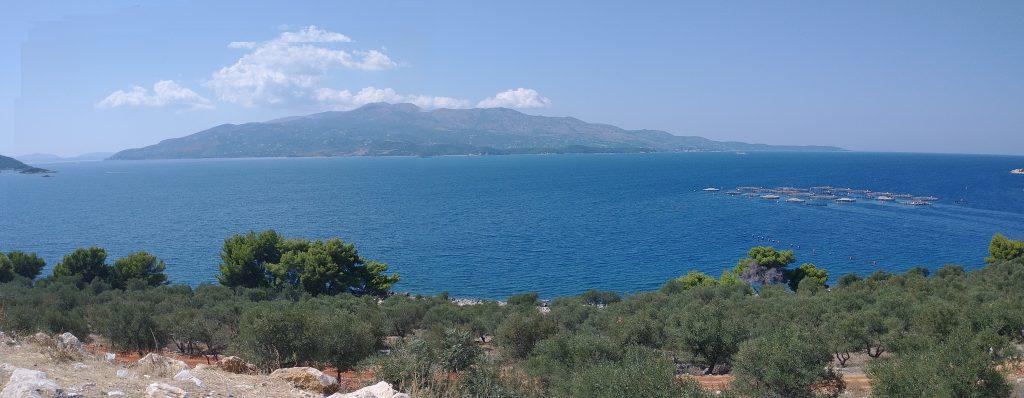
Our faithful guide, Jack drove us four hours to Southernch Albania to see the sites. On the way we noticed numerous scallop and fish farms. Across the water to the west was the Greek island of Crete with a ferry that runs from Crete to Sarande.
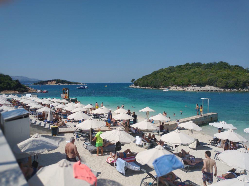
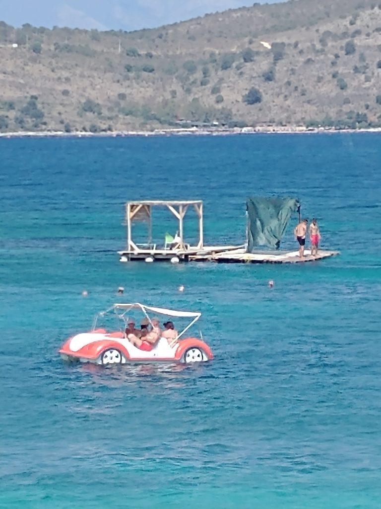
Ksamil
We arrived in Ksamil (Pronounced Samil) in time for a late lunch. Ksamil is called the Riviera of Albania for its clear water and beautiful beaches. At the end of the communist reign, the village of Ksamil did not exist. Now it is a symbol of successful free enterprise with a booming beach and restaurant business. We loved the water taxis (paddle boats) that went between the main beach and the small islands.
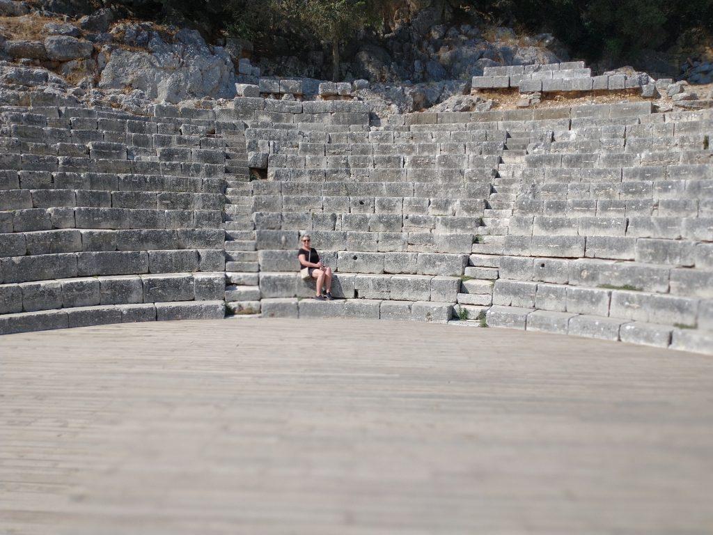
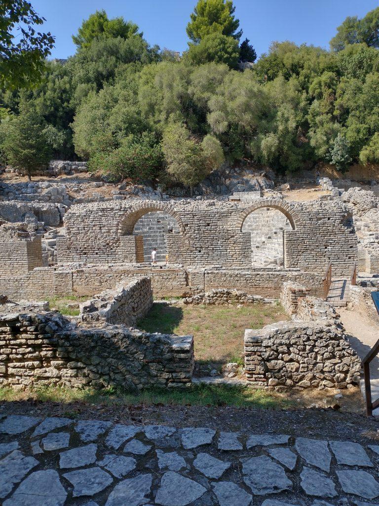
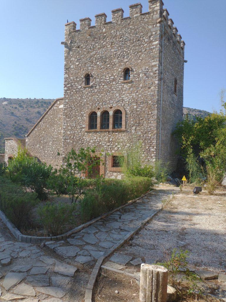
Butrint
First, we walked the same pathways that the Greeks, Romans, Byzantines, Ottomans, and Venetians had walked and were amazed at the ruins of their work.
The earliest habitants of the island were the exiles left after the fall of Troy around 800 B.C. The Hellenites built a temple to Asclepius, the God of Medicine and many of the ruins still remain. The next; inhabitants were the Romans who built a Forum for trade and an amphitheater for entertainment. The stage even had three entrances for the actors to initiate their scenes. In the fifth and sixth century A.D., the Byzantines built a large basilica and baptistry. In the 13th and 14th century the Venetians and Ottomans occupied the island and added additional structures.
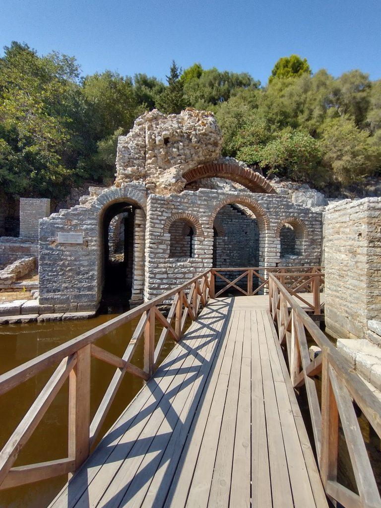
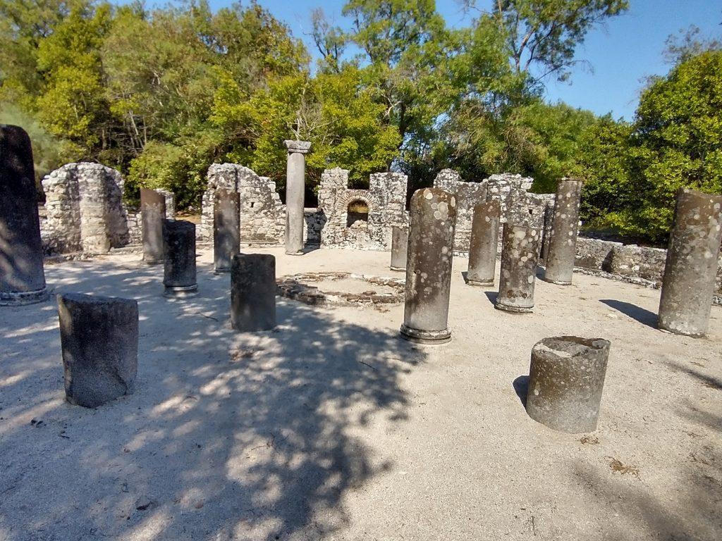
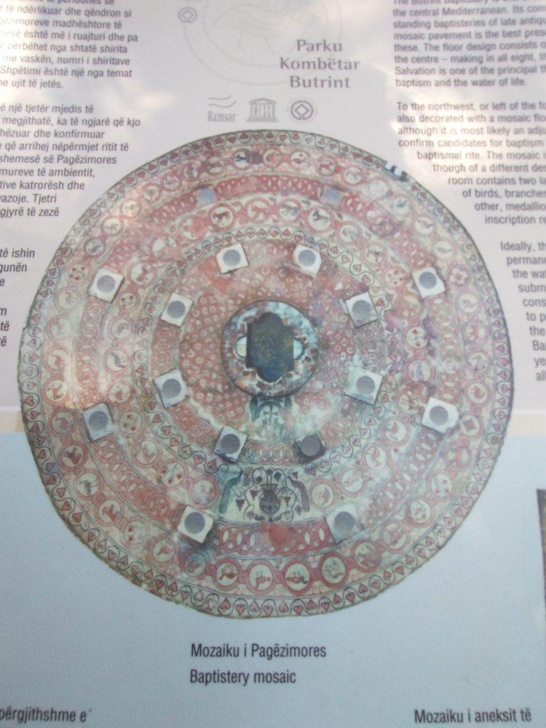
More on the Baptistry
The remains of the Baptisry have eight inner columns and eight outer columns with a beautiful ceramic mosaic floor displaying birds, trees, and animals which may be a reflection of God’s creation. To protect this work of art, the ceramic floors are covered by sand except for a few days every couple of years when on display for public and scientific viewing.
Sarande
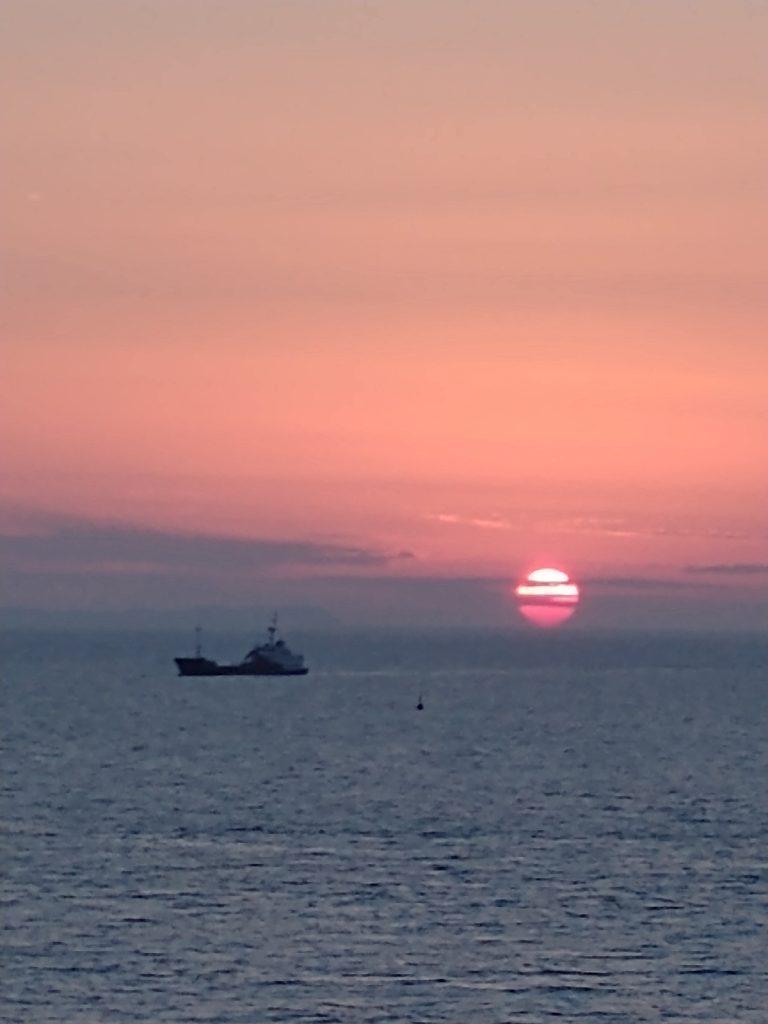
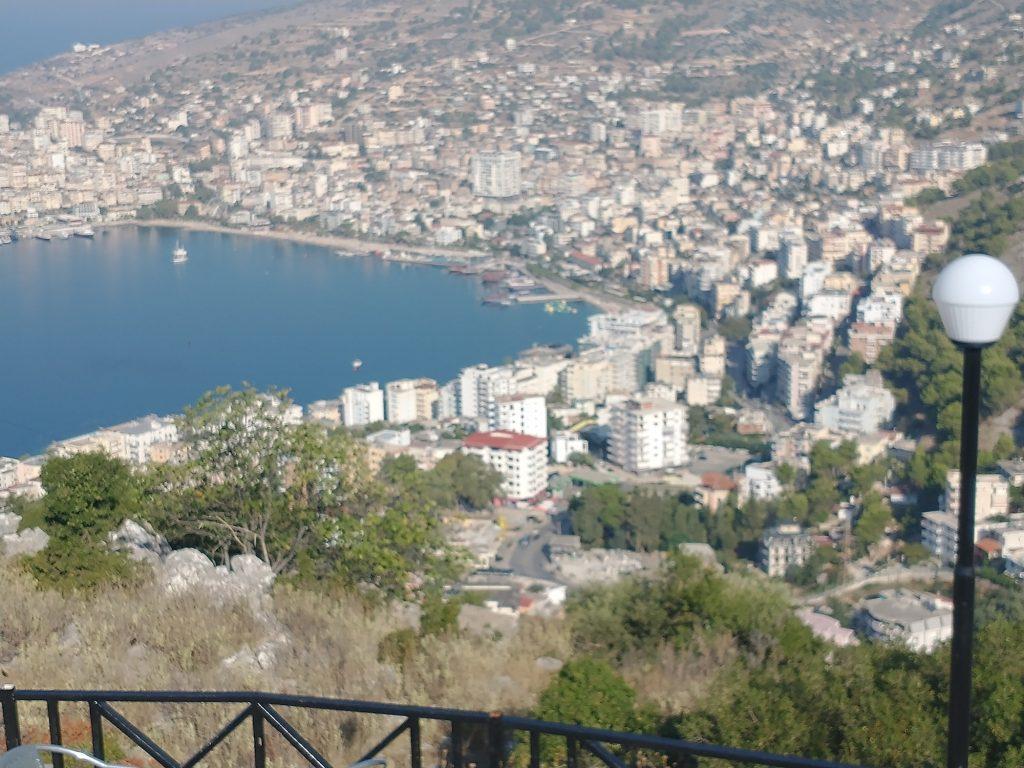
We ended our siteseeing day by checking in to a hotel just in time for a lovely sunset. The next morning we drove to a restaurant at the top of a nearby mountain which overlooked Sarande Bay and the city.
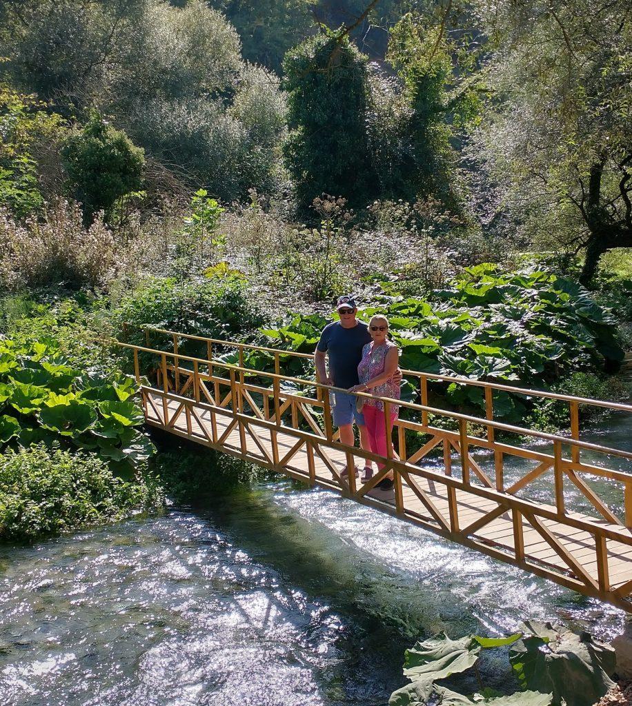
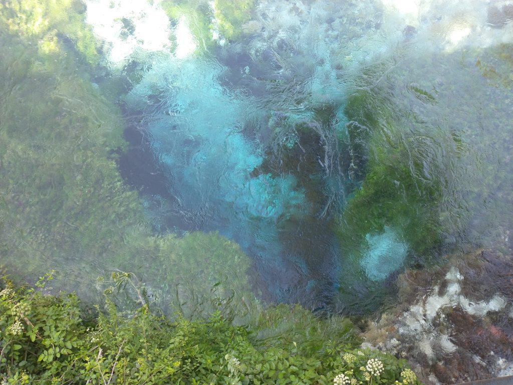
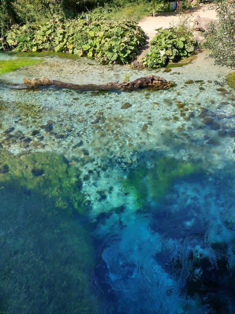
Blue Eye
Our last stop was at Blue Eye National Park. After a mile walk into the park, we reached a bridge over a bubbling mountain brook and continued on to see the “Blue Eye” The Eye is formed by an underground spring 50 feet below a clear trickling stream. The water pressure rising from the bottom is so strong you can only float if you decide to try to swim in the ice-cold water., The circular shape of the area and the darker edges give the phenomena its name. Even downstream, you can clearly see the light clear blue water as it mixes with the stream
Samuel M DeOto
Posted at 18:59h, 01 NovemberHow wonderful!! Such an amazing time for you both. I love your narratives. Pictures are great. Keep on moving on. LOL DITTO
Samuel M DeOto
Posted at 01:21h, 03 NovemberOk.now I know how to follow your travels through your website. Holy hell it’s like an novel with pictures. When I get back from my week at the races I’ll devote my time and look at each of your destinations. As we used to say “far out man”. DITTO